Work
Selected work across geospatial modeling, sensitivity analysis, and modeling infrastructure.
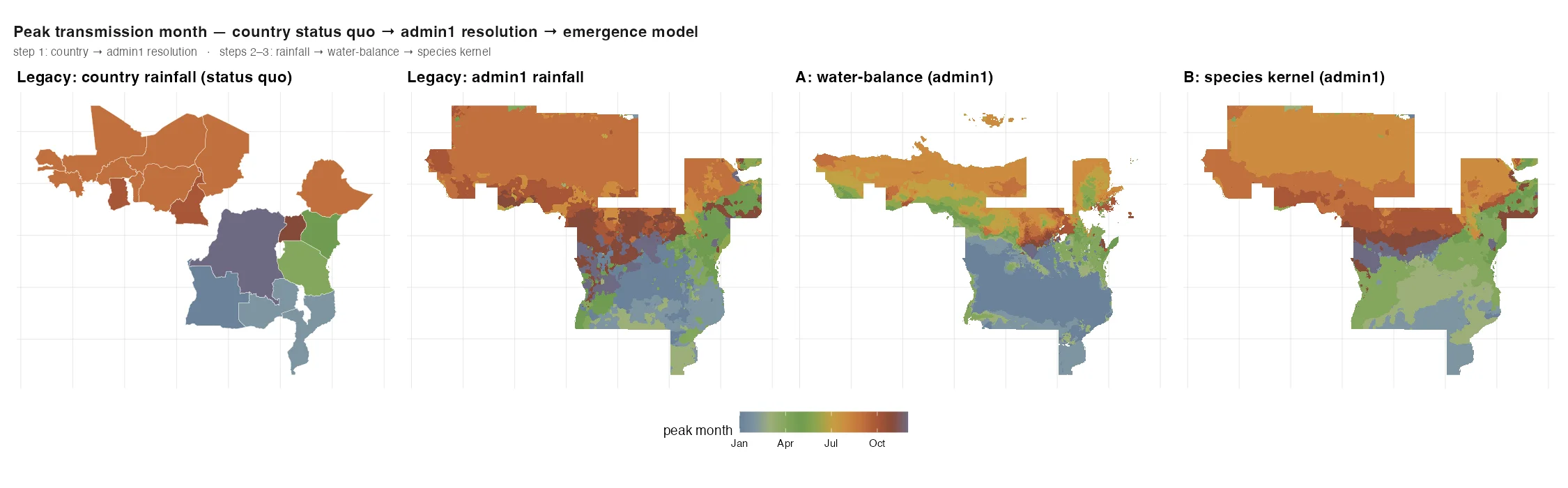
A geospatial seasonality upgrade for malaria models
Rebuilding malaria seasonality from one curve per country into an admin1-resolution emergence surface using water-balance and species-kernel models, tuned against MODIS NDVI phase and exported to OpenMalaria.
read the case study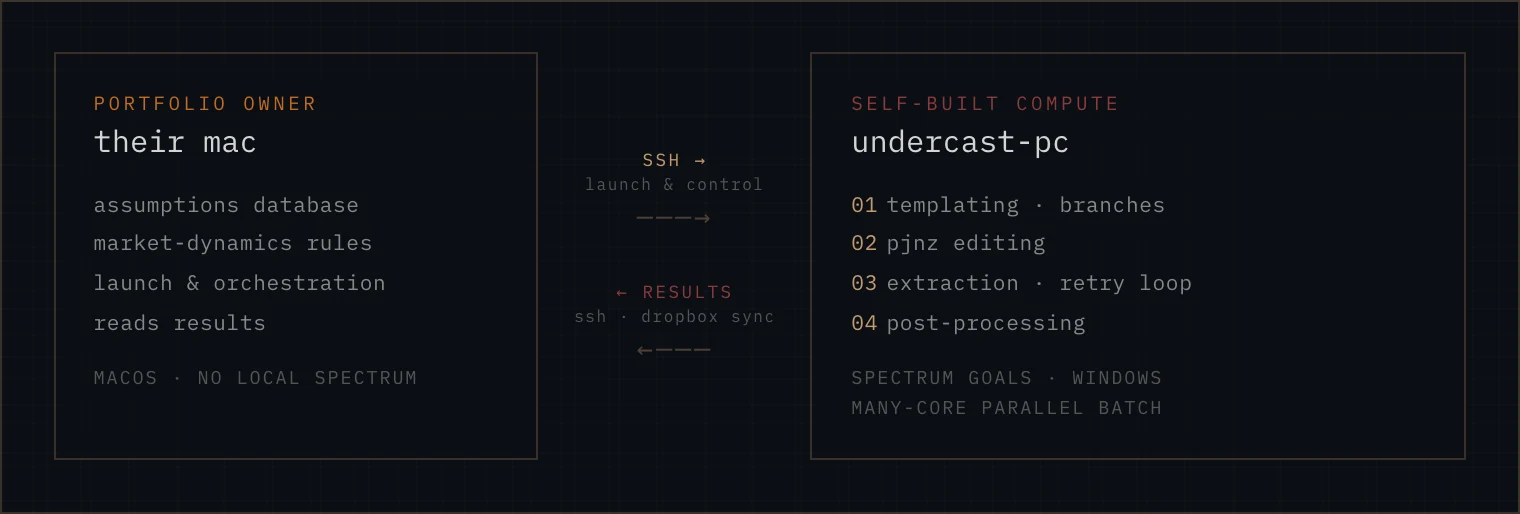
Moving a 55-country HIV portfolio from remote desktop to parallel batch
The portfolio owner had been running Spectrum country files one by one over remote desktop. The pipeline moved 55 countries and 500+ product branches into parallel batch on a multicore Windows box.
read the case study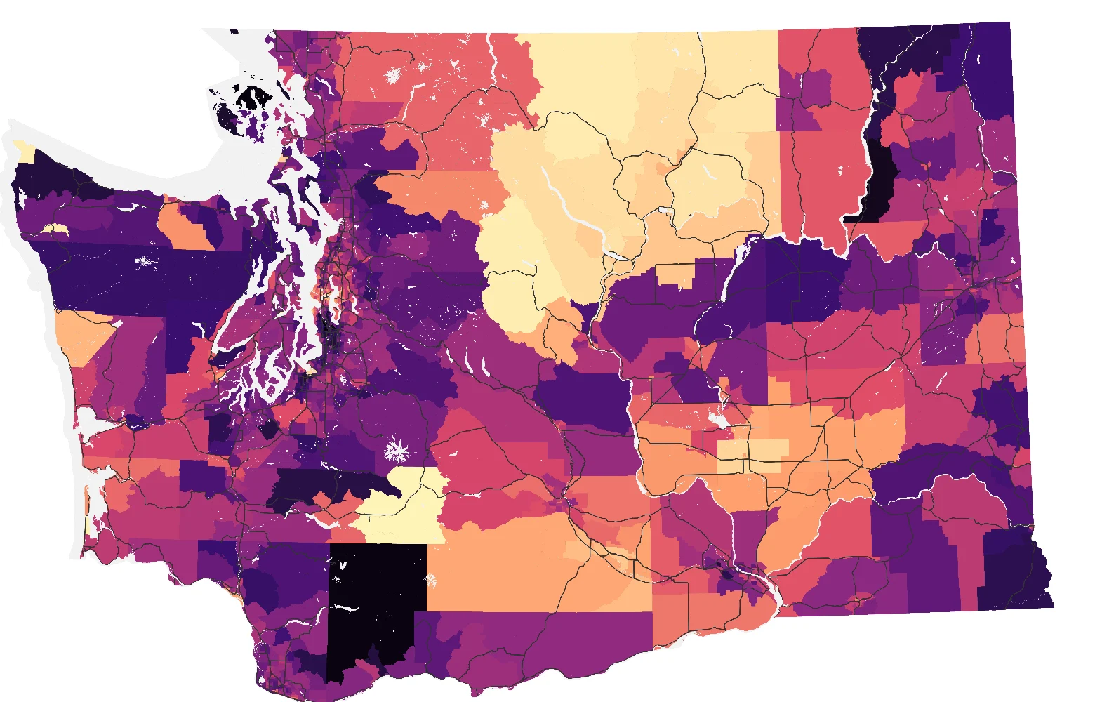
How much does an environmental-justice map depend on the choices behind it?
A variance-based global sensitivity analysis of Washington’s Environmental Health Disparities Map. It rebuilt the index across 5,000 combinations of seven methodology choices and measured their effect on tract ranks and the rank-based “highly impacted” classification.
read the case study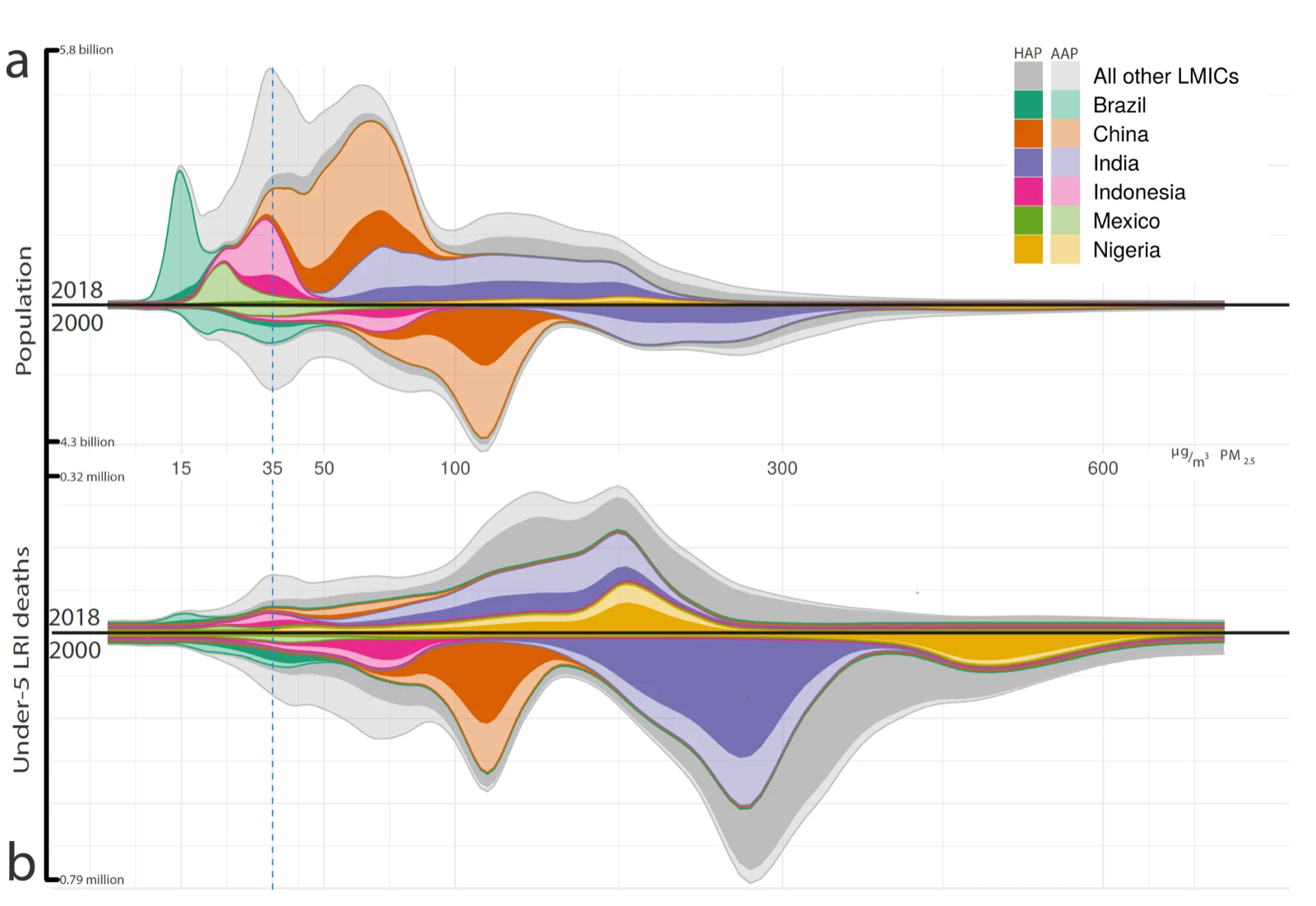
Mapping solid-fuel cooking and attributable under-five respiratory mortality across 98 countries
A 5 km geospatial model of solid-fuel cooking, household air pollution, and attributable under-five respiratory mortality across 98 countries. The work used a stacked ML ensemble feeding a Bayesian geostatistical model and was published in Lancet Global Health.
read the case study